location: Galanta / Slovakia
function: City Center
year: 2011
status: school work
Designers: Jakub Kolarovic
function: City Center
year: 2011
status: school work
Designers: Jakub Kolarovic
The central urban zone in Galante is visibly marked by uncontrolled past urban development of socialist era.
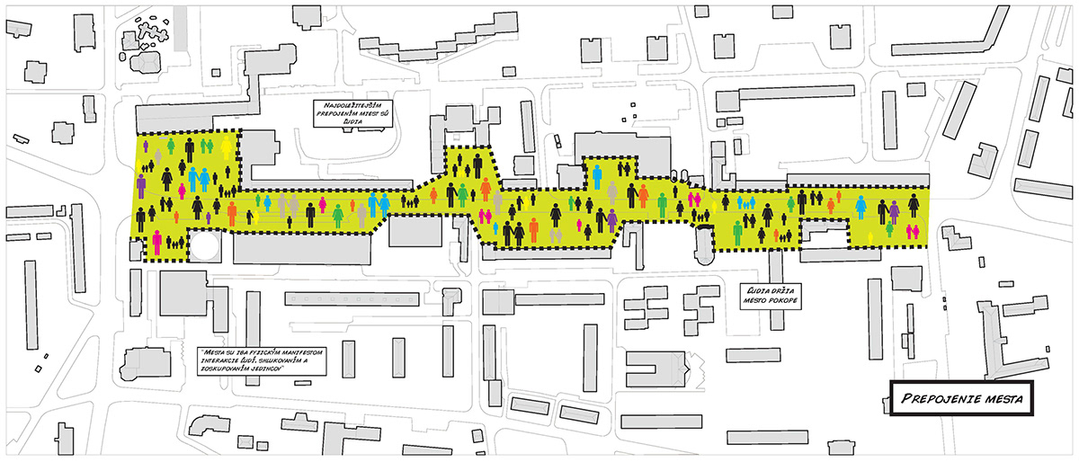
The road, which constitutes, in principle, similar barriers as SNP Bridge in Bratislava should be replaced with a walkway that would restore the city center to Galanta.
After a long consideration of the solution to the problem two solutions have emerged. The first is so short, that can be fit into four words. Demolition of evil, construction of new. Clear, but somewhat indigestible. For the extra-urban environment can be possibly hostile, but on the other hand there are also city dwellers themselves, who live in the area years and the idea of a sudden and rather drastic changes would not have to "survive". Among other things, how much more will people link to something totally new?
City like live organism, needs as well as other living creatures arteries and the movement which in this case are people. Everyone knows that where there is life, there are people. The goal is to get people into the city, so the city can grow and be friendly. Should We create Galanta massive facelift, or a sort of incubator, which would solve more than problem of pedestrians?
And here we come to the solution number two. Instead of costly and time-consuming demolition and re-building, there is a possibility of building "incubator". In this case, the space respectful surroundings with the ability to attract people and bring back life and order to the central urban area.
City intersects the main thoroughfare. Since the plan is to build a bypass around the city, the way may replaced by the pedestrian zone, which will join the northern and southern city back together.

present situation

main thoroughfare as a city barrier

determining the city center area
using the rich potential of city ceter insted of rebilding the area

three reasons why is revitalisation better than demolition
The first step was to limit the space for a new "layer". After, walking and other communications were determined along with the conceptual division of space to create triangular areas. It created the kind of core network - the formula for solving the space on which other layers sequentially deposited. Galanta, like most southern cities have flat topographic character. With the help of embankments and trenches a sort topoprofil was created to diverse environment (slope max. 5 degrees).

concept_1. municipal building as a filter between city pedestrian area and "outside rush"

concept_2. determining the city center area

concept_3. dividing space to triangular areas

concept_4. analyzing pedestrian paths
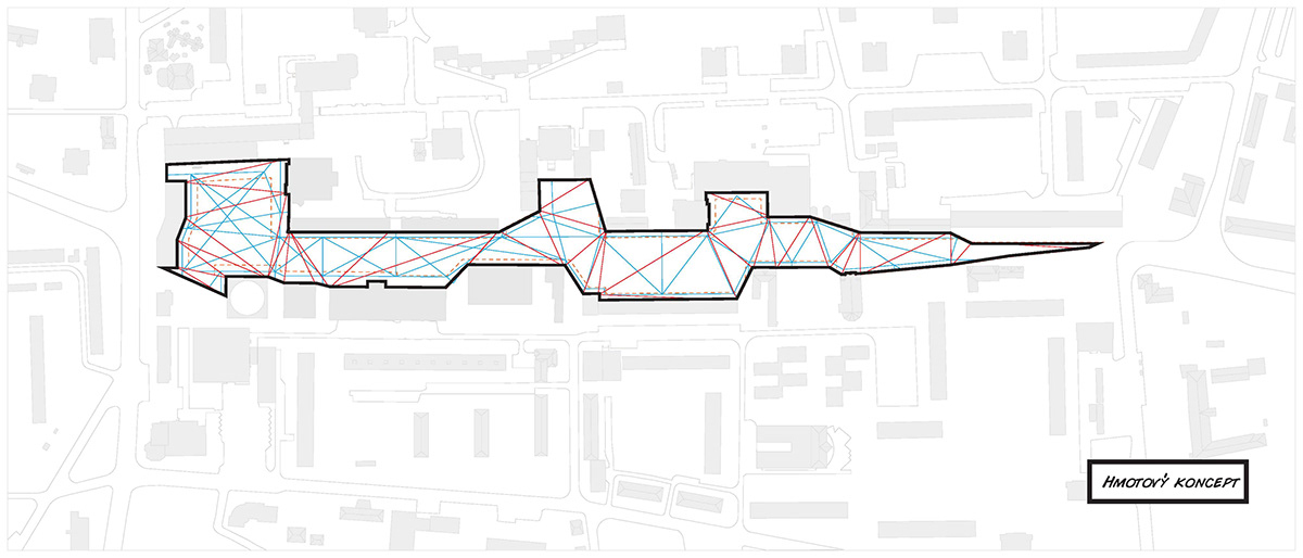
concept_5. pedestrian paths with the triangular grid
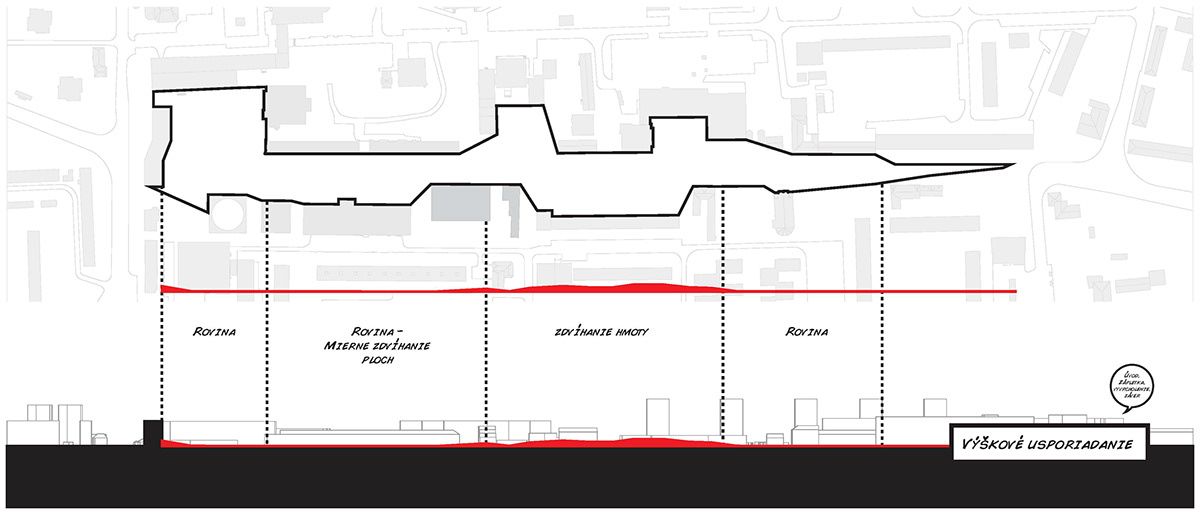
comcept_6. topography

concept_7. direction of surface material
Given the size of the area, it was necessary to subdivide the space into various functional units, so a sense of monotony did not occur . The main square, active zone, recreational zone and church square, are the four basic parts that contain a lot of use for the young and old population of Galanta. The original greenery was left by and accompanied by further. Multifunctional building was added in teh beginig of pedestrian area as the gateway to the city, which attracts visitors and residents themselves to new, old Galanta.
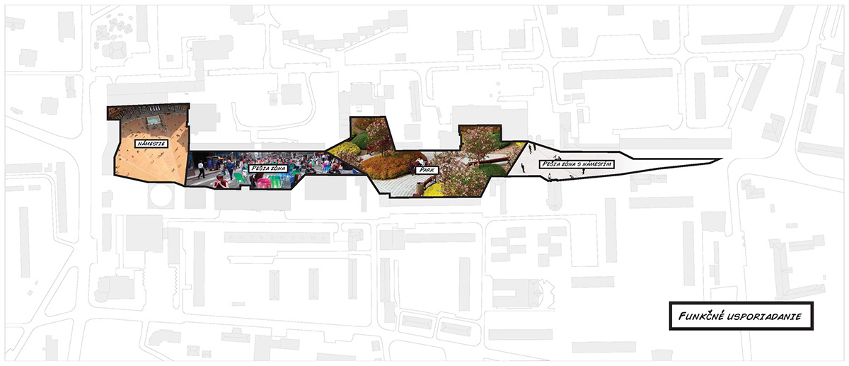
dividing space into 4 areas

main square: reprezetative square, interactive fountain, skating ring, Galanta and Christmas markets, cultural happenings


active zone: interaction, cervices, chat, entertainment, ...


recreational zone: playground, relax, sport, picnic, ...


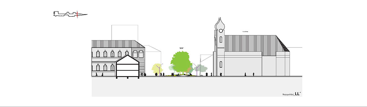
church zone: relax and square area gradually released into the open space of Galanta

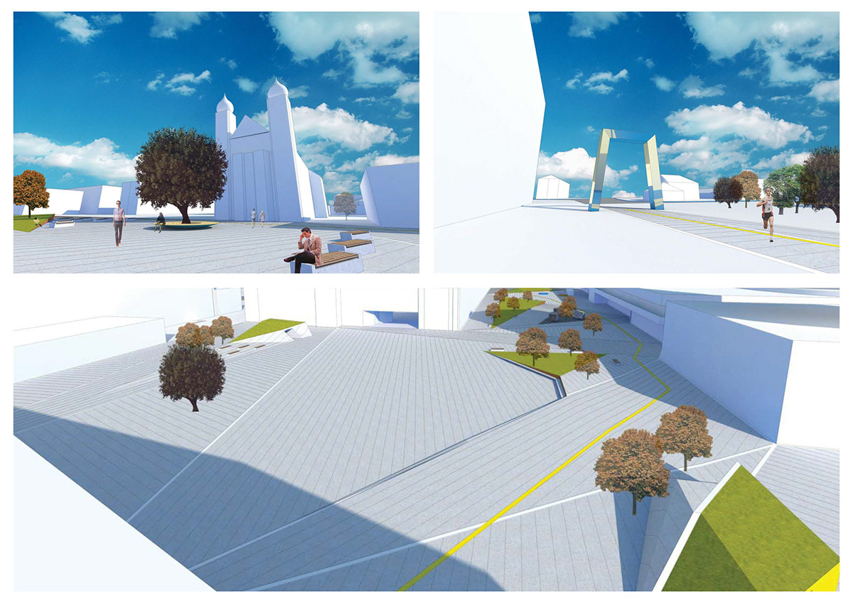
fast visualisations
thanks for watching

